Maps
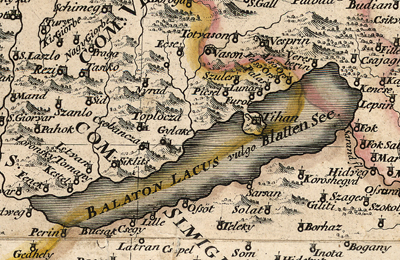
The Map Collection of National Széchényi Library is basically a hungarica collection. Being part of Hungary’s national library, our aim is to collect, with as much integrity as we can, all the Hungary-related printed and manuscripts cartographic documents as well as digitally produced maps, atlases, celestial spheres and globes, etc. As part of a stock comprising over 300,000 items, our collection holds, in addition to the so-called hungarica maps, a rich and highly valuable collection of works of the entire European history of cartography, too. In 1802, Count Ferenc Széchényi donated his famous collections including a collection comprising approximately 6,000 units of maps and atlases to the Hungarian nation. As a collection of graphic documents, this collection has been handled separately since the age of foundation.
During the 19th century, in addition to entities of legal deposit, the Map Collection was significantly enriched by way of receiving donations and also by making acquisitions. To mention just the most notable ones, there was the donation of Count István Illésházy (208 items, 1835); the acquisition of a several hundred-piece map collection of the renowned book and map collector Miklós Jankovich (1836); the purchase of a 300-piece collection of the famous professor of linguistics István Horváth; a highly valuable present (circa 2,200 items, 1895) of Enea Lanfranconi, an excellent water engineer who lived in Bratislava. In the early 20th century, leaders of NSZL recognized the value of large-scale topographic maps in various historical researches, so they made efforts to purchase Hungary-related maps of this kind. As a result of these steps, from the middle of the 1920s onwards, a great volume of large-scale maps arrived in NSZL’s Map Collection. These maps were manuscript and printed maps (cadastral and feudal fee management maps, maps on land utilization, military maps, etc.) but, at the same time, several smaller-scale maps on a variety of topics (county, town, village, etc.) had also been acquired.
In the first half of the 1940s, a great number of unused school maps and atlases from church and secular schools have found their way into the Map Collection of National Széchényi Library. As a result of the communization of baronial and church collections, a bulk of cartographic documents got into NSZL’s Map Collection.
Since 1945, the decisive majority of the annual growth of stock has been provided by entities of legal deposit. However, making purchases of missing hungarica maps also play an important part in the development of NSZL’s Map Collection.
Since 1939, the Map Collection has been a separate department within the organizational structure of National Széchényi Library.
Structure of the collection
- Maps printed before 1850, reference code: TR
- Maps printed after 1850, imaging Hungary and its various parts, reference code: TM
- Maps printed after 1850, depicting other territories than Hungary, reference code: T
- Wall maps, reference code: TF
- Cadastral maps
- Property sketches, reference code: Bv
- Manuscript cadastral maps, reference code: K
- Printed cadastral maps, reference code: NyK
- Separate manuscript maps, reference code: K
- Topographic map documents
- III. Military survey (1:75 000)
- Topographic maps between 1920-1945 (1:25 000, 1:50 000, 1:75 000, 1:200 000)
- Topographic maps of the so-called Gauss-Krüger type, made after 1945 (1:25 000, 1:50 000, 1:100 000, 1:200 000)
- EOTR-type topographic maps (1:10 000, 1:100 000)
- Atlases, reference code: TA
- Globes and celestial spheres, reference code: TG
- Relief maps, reference code: TD
- Digitally produced works and digital copies of printed and manuscripts cartographic documents which are not available in NSZL, reference code: TCD.
For your information, we mention the fact that Apponyi Room to be found in NSZL’s Early and Rare Printed Books Archive also includes several precious maps such as the earliest known printed map of Hungary, the so-called Lazarus Map published in Ingolstadt in 1528, kept together with some of its later versions.
The Old Hungarian Library contains a wood-engraved map entitled”Chorographia Transylvaniae. Sybembürgen” by Johannes Honterus, which is most probably the very first map printed in Hungary. In addition to all these, several precious copies of works from the history of cartography are stored in the Library’s Early Printed Books Archive. Some of the best examples are editions of Sebastian Münster’s Cosmographia és Geographia, Peter Apian’s cosmographic works or the famous city book Civitatis orbis terrarum by Georg Braun and Frans Hogenberg.
Related content:


